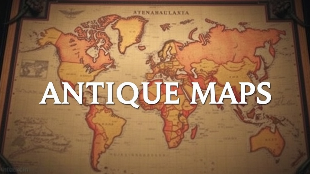
7 Types of Antique Maps Every Collector Should Know About

Bird's Eye View City Maps
Hand-Colored Copperplate Engravings
Vintage Nautical Charts and Sea Maps
Pocket Atlases from the 19th Century
Wall Maps for Schools and Offices
Antique maps offer more than decorative appeal—they're tangible pieces of history that chart humanity's evolving understanding of the world. This guide breaks down seven distinct categories of collectible maps, explaining what makes each valuable, how to spot quality examples, and where beginners should focus their attention. Whether you're hunting for your first purchase or refining an established collection, you'll find practical guidance for handling this fascinating corner of the vintage market.
What Are the Most Valuable Types of Antique Maps to Collect?
The most valuable antique maps typically fall into five categories: world maps from the Age of Discovery, early American colonial maps, city plans from the 16th-18th centuries, celestial charts, and nautical atlases. Rarity, condition, and the reputation of the cartographer drive prices—first editions from Blaeu, Ortelius, or Mercator regularly command thousands at auction.
That said, value isn't everything. Many collectors find deep satisfaction in specialized niches—railroad maps, bird's-eye view city panoramas, or mining district surveys—that offer historical significance without the premium price tags of famous cartographers.
1. Portolan Charts — The Birth of Navigation
Before compass roses and latitude lines, Mediterranean sailors relied on portolan charts—hand-drawn nautical maps created from the 13th through 17th centuries. These remarkable documents feature radiating lines (called rhumb lines) that helped mariners plot courses between ports.
Portolans are extraordinarily rare. Most surviving examples live in institutional collections—the British Library holds several masterpieces—but occasionally, fragments surface at specialized auctions. The distinctive feature? Those spiderweb rhumb lines crossing hand-colored coastlines, usually on vellum rather than paper.
Collecting portolans requires serious capital. Even partial charts from the 1500s start around $15,000. The entry-level collector might consider 19th-century reproductions or portolan-inspired decorative pieces instead.
2. Ptolemaic Maps — Ancient Wisdom, Renaissance Packaging
Claudius Ptolemy's Geographia—written in the 2nd century but largely lost to Europe until the 1400s—sparked a mapping revolution. When printed editions emerged from Rome (1477), Bologna, and Ulm, they carried maps based on Ptolemy's coordinates but interpreted through Renaissance sensibilities.
These woodcut and copperplate maps depict a world that's simultaneously familiar and strange. India points the wrong direction. Scotland bends at impossible angles. Sea monsters populate the margins. The charm lies in this collision of ancient knowledge and medieval imagination.
Early Ptolemaic maps—especially those from the 1477 Rome edition or the 1482 Ulm edition—rank among the most desirable collectibles. A good Ulm World map (the famous "Benedictine" world map) recently sold at Swann Auction Galleries for over $25,000. Later editions from the 1500s offer more accessible entry points, often ranging from $800 to $3,000 depending on condition.
Which Antique Maps Are Best for Beginning Collectors?
British county maps from John Speed's Theatre of the Empire of Great Britain (1611-1612) offer the ideal starting point—plentiful, affordable, and historically significant. American collectors might start with 19th-century state maps from publishers like Tanner, Mitchell, or Colton, which combine reasonable prices with fascinating detail.
Here's the thing about starting small: condition matters more than age. A pristine 1880 map beats a tattered 1680 example every time—both for display appeal and resale value.
| Map Type | Typical Price Range | Best For | Watch Out For |
|---|---|---|---|
| John Speed county maps (1610s) | $400 - $2,500 | Anglophiles, history buffs | Later editions lack hand-coloring quality |
| Tanner/Mitchell US state maps (1820s-50s) | $150 - $800 | American history enthusiasts | Worn center folds; replaced margins |
| Blaeu atlases (1630s-60s) | $800 - $5,000+ | Serious collectors | Fakes exist—provenance matters |
| Bird's-eye view city panoramas (1870s-1920s) | $200 - $1,500 | Decorative display, local history | Reproductions are common |
| Celestial charts (17th-18th century) | $600 - $4,000 | Science history, aesthetics | Spotty paper quality in German examples |
3. Dutch Golden Age Atlases — The Apex of Cartography
The 17th-century Netherlands produced cartography's finest hour. Willem Blaeu, Joan Blaeu, Jan Janssonius, and Frederick de Wit competed to produce ever more elaborate atlases—complete with hand-painted coats of arms, gilded flourishes, and marginal scenes depicting local customs.
The Atlas Maior (1662), Joan Blaeu's eleven-volume masterpiece, remains the holy grail for institutional collectors. Individual maps from this atlas—particularly the voluminous maps of the Americas, Asia, or Europe—circulate regularly in the trade.
The catch? Authenticating Dutch Golden Age material requires expertise. The market has seen sophisticated fakes—especially of the decorative title pages. Reputable dealers like Barry Lawrence Ruderman Antique Maps or Geographicus provide the provenance documentation that protects buyers.
4. Celestial Charts — Mapping the Heavens
Before astronomers photographed galaxies, they drew them. Celestial charts—maps of the night sky—represent a parallel tradition to terrestrial cartography, one that flourished particularly in the Baroque period.
Andreas Cellarius's Harmonia Macrocosmica (1660) stands as the genre's crowning achievement. Its twenty-nine plates depict constellations as classical figures against richly colored backgrounds, planetary orbits as geometric puzzles, and competing cosmological systems (Ptolemaic versus Copernican) side by side. A complete Cellarius atlas in original condition can exceed $100,000 at auction.
More accessible options include John Flamsteed's Atlas Coelestis (1729) or Johann Gabriel Doppelmayr's Atlas Novus Coelestis (1742). These 18th-century works offer comparable beauty at fractionally lower prices—typically $800 to $3,000 for individual plates.
5. American Revolutionary War Maps — History You Can Hold
Few collecting areas match the emotional resonance of maps documenting America's founding. William Faden—"Geographer to the King"—published battle plans, surveys, and reconnaissance maps that shaped how British and American audiences understood the conflict.
Faden's Battle of Bunker Hill (1775) or his North American Atlas (1777) command serious premiums. But the field extends beyond famous names. Amos Doolittle's engravings of Lexington and Concord, produced in 1775, offer revolutionary-era artifacts at more modest prices ($2,000-$8,000 depending on condition).
Worth noting: Revolutionary War material attracts intense competition. Specialized auctions—like those held by Swann Auction Galleries or Sotheby's Americana sales—regularly see bidding wars for significant pieces. The market distinguishes sharply between " Revolutionary War era" maps (period but unrelated to military events) and actual military maps (documenting battles, campaigns, or fortifications).
How Can You Tell If an Antique Map Is Authentic?
Authentic antique maps show characteristic signs of age: uniform paper toning, plate marks from copperplate printing (visible as indentations around the image), and watermark patterns consistent with the stated date. Modern reproductions often reveal themselves through glossy paper, pixelated printing, or anachronistic coloring techniques.
The paper itself tells stories. Maps printed before roughly 1800 use rag paper—cotton and linen fibers that age to warm cream or honey tones. Wood-pulp paper (post-1850) turns brittle and brown. Hold a suspected antique to the light: chain lines (horizontal wires in the paper mold) and watermarks visible in transmitted light offer reliable dating evidence.
6. City Plans and Bird's-Eye Views — Urban Time Capsules
There's something immediately engaging about seeing a familiar city frozen in time. Braun and Hogenberg's Civitates Orbis Terrarum (1572-1617) documented European cities with remarkable consistency—each plate showing street layouts, major buildings, and sometimes even citizens going about their business.
Across the Atlantic, a later tradition emerged: the bird's-eye view panorama. Publishers like Currier & Ives, Burleigh Lithographing Company, and Bachmann produced thousands of aerial perspective views of American towns—most dating from 1860 to 1920. These lithographs (not true maps, strictly speaking, but collected alongside them) show buildings, railroads, and factories in exaggerated detail.
The market for bird's-eye views depends heavily on location. A view of New York or San Francisco commands premiums; a view of small-town Ohio might sell for $200-400. Condition issues are common—many were mounted on brittle backing boards that have since deteriorated. Look for examples with clean margins and minimal foxing.
7. Thematic and Specialized Maps — Finding Your Niche
Beyond geographic representation lies a world of thematic cartography: railroad maps documenting the expansion of American infrastructure, geological surveys revealing mineral wealth, insurance maps (like those produced by the Sanborn Map Company) detailing urban construction materials for fire underwriting.
Railroad maps hold particular appeal for collectors interested in Western expansion. George Cram, Rand McNally, and the various railroad companies themselves produced thousands of maps promoting routes, documenting timetables, and encouraging settlement. These maps—often colorful, densely detailed, and relatively affordable ($100-$500)—make excellent entry points.
Sanborn fire insurance maps serve a different purpose. Created between 1867 and 1970, they document individual buildings, construction materials, and business types at the street level. Complete atlases for major cities (New York, Chicago) sell for thousands, but individual sheets for smaller towns often cost under $100. They're invaluable for genealogists, historic preservationists, and urban history enthusiasts.
The vintage map market rewards curiosity. Start with what draws you—whether that's nautical charts, celestial plates, or railroad timetables—and build expertise gradually. Join collector societies (the International Map Collectors' Society welcomes newcomers), handle material at reputable dealers, and never rush a purchase. The map you pass on today will likely surface again; the map you overpay for becomes an expensive lesson.
Happy hunting.