5 Timeless Antique Maps Every Collector Should Know

Ortelius World Map (1570) - The First Modern Atlas
Blaeu Grand Atlas Maps - Dutch Golden Age Masterpieces
Portolan Charts - Medieval Navigation Treasures
John Speed County Maps - English Cartographic Art
19th Century City Plans - Urban Development Records
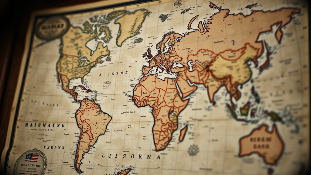
Antique maps offer more than decoration — they're tangible windows into how humanity once understood the world. This post covers five landmark maps that every serious collector should recognize, from the first map to name "America" to the atlas that defined an era. You'll learn what makes each piece historically significant, what to look for when evaluating condition, and why these particular works have held their value across centuries of changing tastes.
Why Do Collectors Pay Premium Prices for Antique Maps?
Collectors pay premium prices for antique maps because scarcity, historical importance, and artistic merit create genuine value that appreciates over time. Unlike mass-produced reproductions, original antique maps represent finite historical artifacts — once the available supply dries up, prices climb steadily.
The market for antique cartography has remained remarkably resilient. While trends in contemporary art fluctuate wildly, rare maps from the 16th through 18th centuries have shown consistent appreciation. A Bonhams auction report from 2023 noted that top-tier specimens from major cartographers regularly command six-figure sums — and the best pieces rarely come to market more than once per decade.
Here's the thing: condition matters enormously. A pristine example of a common map often outperforms a damaged specimen of a rarity. Paper stability, color freshness, margin integrity, and the presence of original hand-coloring all factor into valuation. Collectors who understand these nuances make better purchases — and better investments.
What Is the Most Important Map in American History?
The 1507 Waldseemüller map is the most important map in American history because it represents the first time the word "America" appeared on any printed map — effectively naming an entire continent.
Martin Waldseemüller, a German cartographer working in the small town of Saint-Dié-des-Vosges, created this extraordinary wall map based on reports from Amerigo Vespucci's voyages. The 12 individual woodcut sheets, when assembled, measure approximately 4.5 by 8 feet — an ambitious scale for the early 16th century.
Only one known copy survives complete. The Library of Congress purchased this sole remaining example in 2003 for $10 million — a record that still stands for single maps. The acquisition required an act of Congress and represented a symbolic homecoming for a document that fundamentally shaped how the Western Hemisphere would be understood.
What makes the Waldseemüller map so captivating isn't merely its age. The cartography shows surprising sophistication — the map depicts the Pacific Ocean decades before Magellan's voyage proved its existence. Waldseemüller somehow understood that the lands Columbus encountered weren't part of Asia but rather a distinct landmass. This geographical insight was remarkably ahead of its time.
For collectors, original Waldseemüller material remains impossibly rare. However, later derivatives and references appear occasionally at specialized dealers like Barry Lawrence Ruderman Antique Maps. Even facsimiles from the 19th century command attention — they represent the period when serious academic interest in historical cartography first developed.
Which Antique Atlas Should Beginning Collectors Consider First?
Beginning collectors should consider starting with Abraham Ortelius's Theatrum Orbis Terrarum because it offers the perfect combination of historical significance, relative availability, and accessible price points across multiple editions.
Published in Antwerp in 1570, Ortelius's work holds the distinction of being the first modern atlas — a bound collection of maps designed to be uniform in size and presentation. Before Ortelius, map collecting meant acquiring disparate wall maps, portolan charts, and manuscript sketches of varying quality and scale. The Theatrum standardized the format that would dominate for centuries.
The atlas went through numerous editions during Ortelius's lifetime and after his death in 1598. Early editions contained approximately 70 maps; later expansions included over 150. This evolution offers collectors a fascinating collecting opportunity — you can acquire maps from different editions and track how geographical knowledge advanced across decades.
Individual maps from the Theatrum regularly appear at auction and through specialized dealers. Prices vary dramatically based on the region depicted, condition, and whether original hand-coloring survives. A common European region might cost $800-$1,500 in good condition. A map showing the Americas — particularly one depicting California as an island (a charming error that persisted for over a century) — could command $3,000-$6,000.
Worth noting: Ortelius maps feature distinctive decorative elements. Ships populate the oceans. Sea monsters lurk in unexplored waters. Cartouches display elaborate Renaissance ornamentation. These artistic flourishes make them particularly appealing for display — they read as artwork first, historical documents second.
What Makes Blaeu's Atlas Maior the Pinnacle of Dutch Cartography?
Joan Blaeu's Atlas Maior represents the pinnacle of Dutch cartography because its eleven volumes combined scientific accuracy with unsurpassed production quality — creating the most expensive book ever published in the 17th century.
The Dutch Golden Age produced extraordinary wealth, and Blaeu catered directly to the era's merchant princes. The Atlas Maior (1662) contained 594 maps across approximately 4,000 pages. Individual volumes measured 20 by 13 inches — substantial folios designed to impress visitors in the libraries of the wealthy.
Original complete sets rarely appear on the market. When they do, prices typically exceed $500,000. The British Library holds one of the finest examples; the Bibliothèque nationale de France maintains another. Private collectors who own complete sets generally acquired them decades ago and have no intention of selling.
The catch? You don't need a complete set to appreciate Blaeu's achievement. Individual volumes — particularly those covering specific regions like the British Isles or Italy — surface periodically. Single maps extracted from damaged volumes offer an entry point for collectors with more modest budgets. A Blaeu map of Spain or Portugal might cost $1,200-$2,500 depending on condition and coloring.
Blaeu's workshop employed the finest engravers in Amsterdam. The maps feature meticulous detail — every town, river, and forest carefully rendered. The coloring (applied by specialized painters working from the Blaeu workshop) remains remarkably vibrant on well-preserved examples. When you examine a Blaeu map beside cheaper contemporary competitors, the quality difference becomes immediately apparent.
How Did Medieval Mapmakers View the World?
Medieval mapmakers viewed the world through a theological lens — creating maps like the Hereford Mappa Mundi (circa 1300) that prioritized spiritual narrative over geographical accuracy.
The Hereford Mappa Mundi, currently displayed at Hereford Cathedral in England, represents the largest surviving medieval map still in existence. Measuring 5 feet 2 inches high and 4 feet 6 inches wide, this single sheet of vellum depicts a circular world with Jerusalem at the center — reflecting the medieval Christian worldview that placed the Holy City at the heart of creation.
East appears at the top of the map (hence our term "orientation" — toward the Orient). The Garden of Eden sits at the apex. Mythical creatures populate the margins — blemmyes with faces on their chests, sciapods with single giant feet, dragons and unicorns. These weren't mere fantasy; they represented a genuine belief in the marvelous diversity of God's creation.
That said, the Hereford map isn't entirely inaccurate. The Mediterranean coastline shows surprising fidelity to reality. Major cities appear in roughly correct relative positions. The map served multiple purposes — spiritual education, geographical reference, and visual spectacle for cathedral visitors.
For collectors, true medieval manuscript maps remain virtually unobtainable — museums and religious institutions hold nearly all surviving examples. However, printed reproductions and scholarly studies offer accessible alternatives. The British Library's digital collection provides high-resolution imagery that reveals details invisible to the naked eye.
Collectors interested in this aesthetic might consider 16th-century "T-O" maps — printed derivatives of the medieval tradition that occasionally appear at reasonable prices. Sebastian Münster's Cosmographia (1544) includes woodcut maps that bridge the medieval and Renaissance worldviews.
Comparing the Five Landmark Maps: A Collector's Guide
| Map/Atlas | Creator | Date | Est. Value (Fine Condition) | Availability |
|---|---|---|---|---|
| Waldseemüller World Map | Martin Waldseemüller | 1507 | $10M+ (unique) | Effectively unobtainable |
| Theatrum Orbis Terrarum | Abraham Ortelius | 1570-1612 | $800-$6,000 per map | Regularly available |
| Atlas Maior | Joan Blaeu | 1662 | $1,200-$500,000+ | Individual maps available |
| Hereford Mappa Mundi | Unknown (medieval) | c. 1300 | Priceless | Museum-held only |
| Theatre of the Empire | John Speed | 1611-1612 | $800-$4,000 per map | Moderately available |
Why Should Canadian Collectors Know John Speed?
Canadian collectors should know John Speed because his 1611-1612 Theatre of the Empire of Great Britaine represents the first printed atlas of the British Isles — and many Canadian families trace their origins to the regions Speed depicted with such care.
John Speed worked as a tailor in London before finding his true calling as a cartographer. His lack of formal geographical training may have been an advantage — he approached mapmaking as a storyteller rather than a surveyor. The result was a collection of county maps so charming, so immediately appealing, that they've remained collectible for over four centuries.
Speed's maps overflow with decorative elements. Town plans appear as insets — miniature architectural drawings showing how York, Chester, or Exeter looked in the early 17th century. Costumed figures representing regional dress populate the margins. Royal coats of arms proclaim allegiance to the Stuart crown. These aren't merely maps; they're snapshots of Jacobean England frozen in copperplate.
For collectors in Calgary and across Canada, Speed maps hold special resonance. Many Canadian families — whether of United Empire Loyalist descent, Scottish emigrant stock, or English settler heritage — can trace their roots to specific English counties. Owning a Speed map of Yorkshire, Devon, or Lancashire creates a tangible connection to ancestral homelands.
Individual Speed county maps typically range from $800 for common examples to $4,000 for rare counties in exceptional condition. The complete atlas — when it appears — commands $30,000-$80,000 depending on completeness and binding condition. Look for examples with original outline coloring — the subtle washes of pink, green, and yellow that contemporary colorists applied to distinguish boundaries.
Reputable dealers like The Map House in London regularly stock Speed material. When evaluating a Speed map, check the margins carefully — many examples were trimmed by earlier owners attempting to fit them into albums or frames. Full margins with deckle edges add considerable premium.
The world of antique map collecting rewards curiosity and patience. Whether you're drawn to the scientific precision of Blaeu, the pioneering spirit of Waldseemüller, or the medieval mystery of the Hereford map, each piece offers something no reproduction can match: authentic contact with how someone centuries ago imagined the world. Start with what speaks to you. Study condition obsessively. Buy from established dealers who guarantee authenticity. And remember — the best collections weren't built overnight. They grew through decades of careful acquisition, each map chosen not for investment potential but for the story it tells.
Happy hunting.