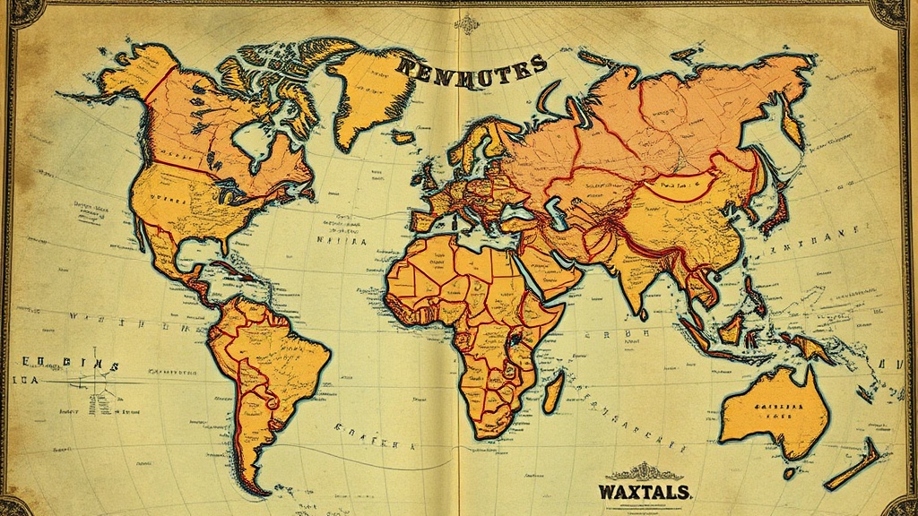
5 Secrets to Finding Rare Antique Maps Worth a Fortune

Learn to Date Maps by Cartographic Details
Search for Hand-Colored Copper Plate Engravings
Check Estate Sales in Historic Coastal Towns
Identify Valuable Mapmakers and Publishers
Look for Hidden Gems in Old Atlases and Books
Finding an antique map worth thousands — sometimes tens of thousands — isn't luck. It's knowing where to look, what to look for, and which mistakes to avoid. This post reveals five proven strategies that seasoned collectors use to uncover rare maps hiding in plain sight: estate sales, overlooked map dealers, specific cartographic errors, and auction blind spots. Whether hunting for a 16th-century Ortelius or a 19th-century railroad survey, these methods work.
Where Do the Best Antique Maps Actually Hide?
The best antique maps hide in three places: estate sales in older neighborhoods, regional auction houses outside major cities, and the dusty corners of secondhand bookstores that haven't been digitized. Most collectors obsess over eBay and major auction sites — which means they're competing with thousands of others. The real finds happen where nobody else is looking.
Estate sales in neighborhoods built before 1950 often yield cartographic gold. Families who've lived in the same home for generations sometimes have atlases, wall maps, or survey documents tucked in attics and basements. The key is arriving early — really early — and knowing what you're seeing. A 1907 Rand McNally Commercial Atlas looks unremarkable to most estate sale shoppers. To a trained eye, it's a $400-$800 item depending on condition.
Here's the thing: estate sale companies rarely research maps properly. They price by size and apparent age. A massive 4x6 foot 1880s county wall map might sit at $75 because "it's just an old map." That same map, properly identified as a Beers, Ellis & Co. hand-colored county atlas, sells for $1,200+ at specialized map auctions.
Regional auction houses — think places like Christie's country offices, smaller houses in the Midwest, or Canadian auctioneers — often list maps in "Books & Ephemera" lots. The serious money concentrates at Swann, Sotheby's, and Bonhams. That leaves value sitting in Des Moines, Buffalo, and Calgary auction houses where map specialists aren't bidding.
What Map Features Make a $50 Find Worth $5,000?
Five specific features separate valuable antique maps from decorative wall filler: first state (first printing), hand-coloring contemporary to publication, significant cartographic errors, provenance connecting to historical figures, and original margins without trimming.
First state maps — the earliest printed version before corrections — command premiums. When California appeared as an island on 17th-century Dutch maps, that "error" (based on then-current Spanish reports) makes those first-state maps worth 3-5x more than later corrected versions. The Barry Lawrence Ruderman Antique Maps gallery regularly sells first-state island-of-California maps for $8,000-$25,000.
Hand-coloring matters enormously — but only if contemporary. Modern coloring looks flat, too perfect. Period coloring (applied in the 1600s-1800s by professional colorists) shows variation, slight bleeding at borders, and oxidizes differently. A 1640 Blaeu map with original hand-coloring sells for double an uncolored example. The same map with garish 1950s coloring? Worth less than the uncolored version.
Cartographic errors drive serious collector interest. The "Limiter" error on some 18th-century maps (showing non-existent islands), distorted Great Lakes shapes pre-1760, or Australia connected to New Guinea — these aren't mistakes to avoid. They're features that date the map precisely and create scarcity.
| Feature | Value Impact | What to Check |
|---|---|---|
| First state printing | +200-500% | Compare to institutional copies at Library of Congress |
| Contemporary hand-coloring | +50-200% | Check verso for oxidation, uneven application |
| Original margins (uncut) | +30-100% | Look for deckle edges, binder's holes |
| Major cartographic error | +100-300% | Research the map's "known errors" in reference books |
| Historical provenance | Variable (can be huge) | Ex-libris plates, auction records, family documentation |
The catch? Most sellers don't know state differences exist. They price by the cartographer's name and apparent age. A second-state Ortelius might sit at $300. The first state of the same plate? $4,000. The difference is often one tiny changed place name or an added ship in the corner.
How Can You Tell if an Antique Map is Authentic (Not a Reproduction)?
Authentic antique maps show specific physical characteristics that reproductions cannot replicate: plate marks from copper printing presses, chain lines in laid paper, rag content that ages to warm cream (not bright white), and oxidation patterns in hand-coloring. Learning to spot these separates collectors from decoration buyers.
Start with the paper. Genuine antique maps (pre-1800) use rag paper — cotton and linen fibers. Hold it to light. You'll see chain lines (vertical wires in the paper mold) and laid lines (horizontal). Modern paper is uniform. Reproductions on artificially aged paper feel wrong — too stiff, too brittle, or the aging stops abruptly at the edges.
Plate marks matter enormously for 16th-18th century maps. Copperplate printing left an indented rectangle where the press squeezed paper into the plate. This mark is nearly impossible to fake convincingly. Run your finger along the border. Feel that subtle depression? That's authentication you can touch. Reproductions printed offset or digitally have flat, uniform surfaces.
That said, not all valuable maps have plate marks. 19th-century lithographs — like the magnificent Mitchell's New General Atlas maps — were printed by planographic process. No plate mark exists. For these, examine the coloring. Period watercolor has transparent, layered quality. Modern printing uses opaque, uniform dots visible under 10x magnification.
Worth noting: some reproductions are themselves collectible. The Facsimile Edition of the 1639 Joan Blaeu Atlas Maior (published 1967) sells for $200-400 complete. Not bad for a reproduction — but you must know what you're buying. Ethical dealers label these clearly. Unethical ones rely on buyer ignorance.
Which Antique Map Dealers and Resources Actually Deliver Value?
The antique map trade splits into three tiers: high-end galleries (Ruderman, Arader, Martayan Lan) where authentication is guaranteed but premiums are steep; mid-level dealers at map fairs and on sites like RareMaps.com offering fair prices with reasonable expertise; and the wild west of eBay, estate sales, and charity shops where knowledge creates profit.
Established dealers provide something undervalued: returns and authenticity guarantees. When spending $2,000+ on a single map, that matters. The International Map Collectors' Society (IMCoS) maintains a directory of vetted dealers. Members agree to ethical standards including accurate dating, disclosure of repairs, and fair representation of condition.
For self-directed hunters, build a reference library before buying. Map Collecting: A Guided Tour by Carl Moreland and David Bannister remains the standard introduction. For American maps, County Atlas of the United States by Walter Ristow helps identify valuable state and county atlases. These books pay for themselves many times over by preventing one bad purchase.
Online, the David Rumsey Map Collection offers free access to 150,000+ high-resolution maps. Before buying any map, compare it to Rumsey's documented examples. Plate characteristics, coloring style, and precise dimensions should match. If the seller's map differs significantly from the documented version, ask why — then verify the answer independently.
What Mistakes Destroy Value in Antique Map Collecting?
The five value-destroying mistakes: buying trimmed maps (margins cut to fit frames), ignoring condition issues like foxing and water stains, overpaying for common "pretty" maps while missing scarce plain ones, failing to research provenance, and attempting DIY restoration with tape or glue.
Trimming is heartbreaking. A 1750s Bellin map of North America loses 60% of its value if the margins were trimmed to fit a 1950s frame. Original margins contain publisher information, plate numbers, and evidence of authenticity. Never buy a map that's been cut down unless the price reflects the damage — and most sellers don't discount enough.
Condition problems compound. Light foxing (those brown spots) is acceptable on 18th-century maps. Heavy foxing, water stains, or mold damage isn't. Repair attempts often make things worse. Scotch tape applied in the 1960s oxidizes and stains paper irreversibly. Modern "archival tape" is only slightly better. Professional paper conservators use wheat starch paste and Japanese tissue — techniques requiring training.
Here's the thing about "pretty" maps: the most visually striking examples often are the most common. A colorful 19th-century Mitchell School Atlas map looks gorgeous. They printed tens of thousands. Scarce items — early county land ownership maps, obscure surveyor's manuscripts, or maps from small print runs — often look plain. Learn to appreciate brown, uncolored maps with interesting information. That's where the money is.
Provenance research takes work but pays. A map from the library of a known collector (documented in auction records) carries premium. A map with no history — even identical in appearance — sells for less. When you acquire a map, document where you bought it, when, and from whom. Future buyers (or your heirs) will value that chain of custody.
Start with one region or one cartographer. Specialization builds expertise faster than scattered buying. Focus on American Civil War military maps, or 17th-century Dutch cartography, or 19th-century railroad surveys. Deep knowledge in a narrow field consistently beats shallow knowledge across everything. The collectors who find fortunes in antique maps aren't luckier — they're better educated about exactly what they're seeking.